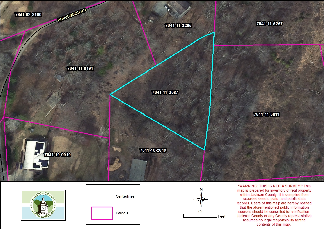
Parcel Report
Property Report for 7641-11-2087
Parcel Information
- Parcel ID: 7641-11-2087
- Parcel Address: LT 10 BRIARWOOD RD
- Neighborhood Name: Buchanan Loop
- Property Description: LT 10 BRIARWOOD
- Sale Date: 2013-06-26
- Sale Price: $0
- Plat Reference: None
- Transferring Reference: 13E/182
- Township: WEBSTER
- Assessed Acres: 0.72
Ownership Information
- Owner Name #1: DAVENPORT, JEAN
- Owner Name #2: None
- Mailing Address 1: 4621 NC HIGHWAY 55 W
- Mailing Address 2: None
- City/State/Zip: COVE CITY NC 28523
- Owner Account: 3832
Tax/Value Information
- Fire District: SYLVA 5 MI
- Building Value: $0
- Land Value: $11,750
- Assessed Total Value: $11,750
Zoning Information
- Zoning District: None
- Zoning Area: Webster R1