Parcel Report
Property Report for 7640-25-6649
Parcel Information
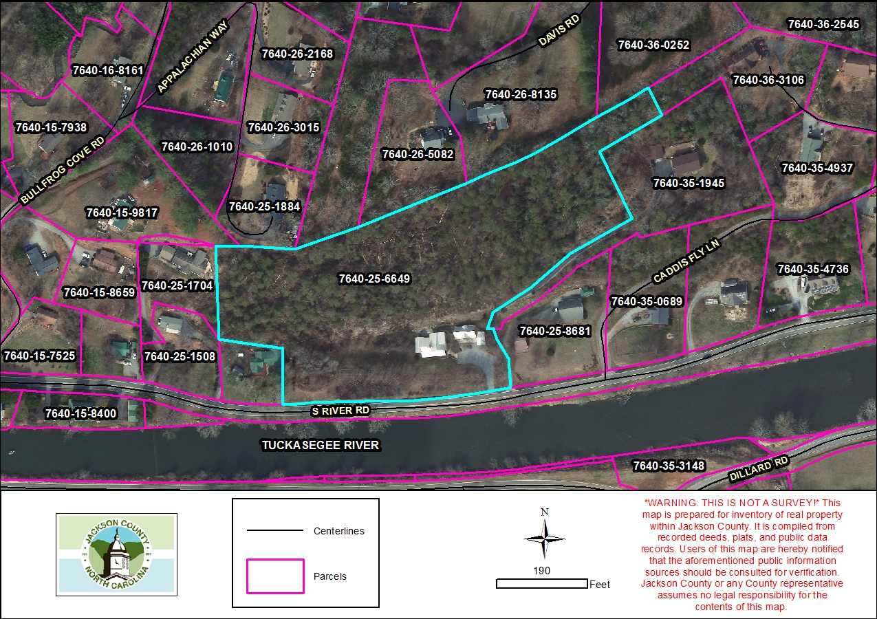
- Parcel ID: 7640-25-6649
- Parcel Address: 1048 S RIVER RD
- Neighborhood Name: Webster
- Property Description: S RIVER RD
- Sale Date: 2017-04-24
- Sale Price: $190,000
- Plat Reference: None
- Transferring Reference: 2187/1110
- Township: WEBSTER
- Assessed Acres: 6.31
Ownership Information
- Owner Name #1: SCHILLING, FREDERICK A
- Owner Name #2: SCHILLING, CAROL F
- Mailing Address 1: 223 HAWKS VIEW DR
- Mailing Address 2: None
- City/State/Zip: CANTON NC 28716
- Owner Account: 178930
Tax/Value Information
- Fire District: SYLVA 5 MI
- Building Value: $668,068
- Land Value: $166,570
- Assessed Total Value: $834,638
Zoning Information
- Zoning District: None
- Zoning Area: Webster ETJ