Parcel Report
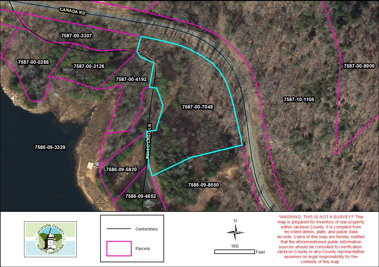
Property Report for 7587-00-7048
Parcel Information
- Parcel ID: 7587-00-7048
- Parcel Address: LT 38 CANADA RD
- Neighborhood Name: Cedar Cliff Lake
- Property Description: LT 38 CEDAR CLIFF
- Sale Date: 2006-06-19
- Sale Price: $0
- Plat Reference: 6/203
- Transferring Reference: 1595/662
- Township: RIVER
- Assessed Acres: 3.93
Ownership Information
- Owner Name #1: STOVALL, KRISTI
- Owner Name #2: None
- Mailing Address 1: 6790 WIREVINE DR
- Mailing Address 2: None
- City/State/Zip: BROOKSVILLE FL 34602
- Owner Account: 137460
Tax/Value Information
- Fire District: CULLOWHEE 5 MI
- Building Value: $0
- Land Value: $114,950
- Assessed Total Value: $114,950
Zoning Information
- Zoning District: None
- Zoning Area: None