Parcel Report
Property Report for 7556-77-0092
Parcel Information
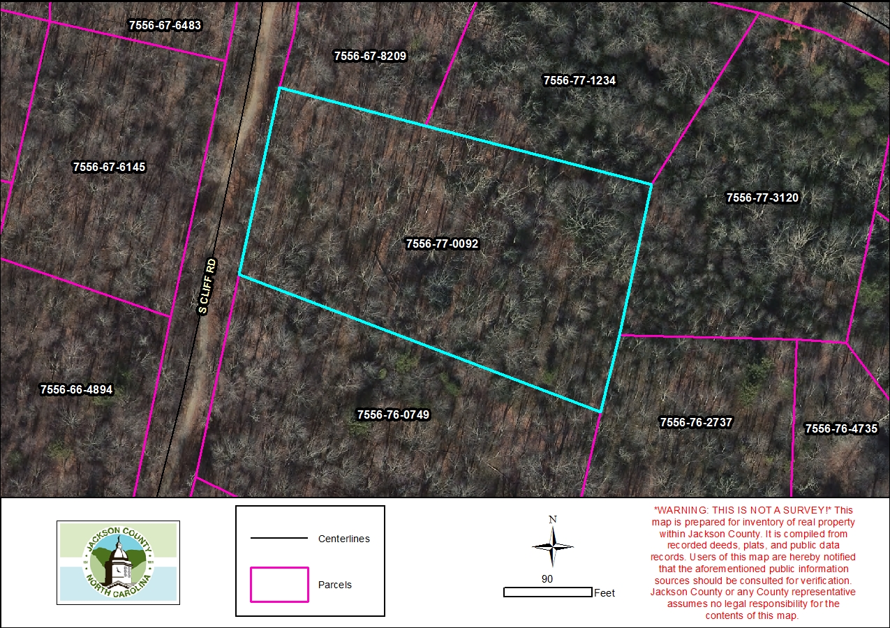
- Parcel ID: 7556-77-0092
- Parcel Address: LT 17 S CLIFF RD
- Neighborhood Name: Cedar Cliff Farm
- Property Description: LT 17 CEDAR CLIFF FARMS
- Sale Date: 2022-10-19
- Sale Price: $95,000
- Plat Reference: 20/108
- Transferring Reference: 2344/1843
- Township: MOUNTAIN
- Assessed Acres: 1.98
Ownership Information
- Owner Name #1: R&D MOUNTAIN PROPERTIES LLC
- Owner Name #2: None
- Mailing Address 1: 9729 CAMPI DR
- Mailing Address 2: None
- City/State/Zip: LAKE WORTH FL 33467
- Owner Account: 192289
Tax/Value Information
- Fire District: CULLOWHEE PC 10
- Building Value: $0
- Land Value: $12,720
- Assessed Total Value: $12,720
Zoning Information
- Zoning District: None
- Zoning Area: None